Mbarara, Uganda (seismic) archived on October 4, 2017
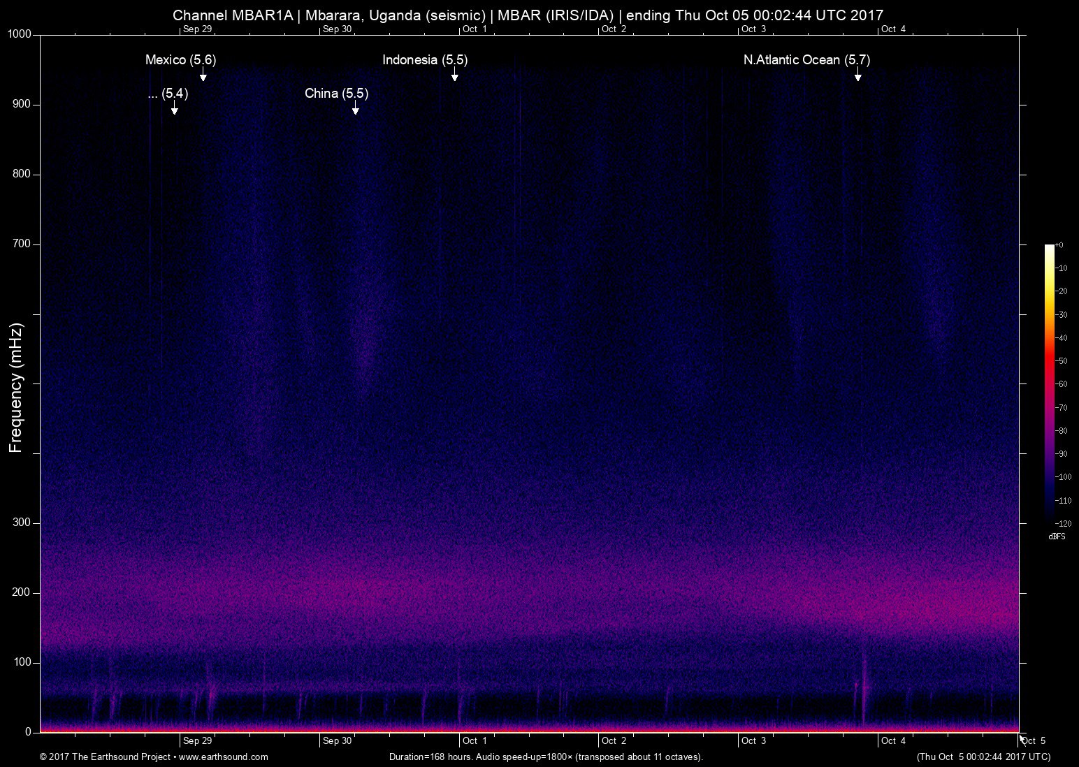
Annotated events during this period:
Time (UTC) Mag Lat Lon Depth Description
======================== === ====== ====== ===== ===========
Tue Oct 3 20:39:04 2017 5.7 -49.32 13.46 6 N.Atlantic Ocean (North Atlantic Ocean)
Sat Sep 30 23:15:29 2017 5.5 128.54 3.94 6 Indonesia (251km NNE of Tobelo, Indonesia)
Sat Sep 30 06:14:36 2017 5.5 105.00 32.32 6 China (3km WSW of Magong, China)
Fri Sep 29 04:00:22 2017 5.6 -94.05 14.90 6 Mexico (119km SSW of Tres Picos, Mexico)
Thu Sep 28 23:11:15 2017 5.4 -179.79 -24.87 5 S.of the Fiji Islands (South of the Fiji Islands)
Total: 5 events.
About this archived stream:
| Station : | MBAR (network: IRIS/IDA) at Mbarara, Uganda |
| Sensor : | Geotech KS54000 triaxial broadband borehole seismometer |
| Recorder : | Quanterra Q330 @ 100 Hz |
| Pod : | inanna@x.x.0.135 | macOS 10.12.5 | psm v. 122 |
| Speedup : | ×1,800 (transposed up about 11 octaves) |
| Loop duration (real) : | 168 hours |
| Loop duration (audio) : | 05:36 (stereo) |
| Data channels : | miniseed (II.MBAR.00.BH1 II.MBAR.00.BH2) |
| RMS : | 0.003238 |
| Spectrogram type : | raw |
| Gain correction : | 20dB |
| SoX post-processing : | highpass -2 90 highpass -2 90 compand 0.001,0.01 6:-80,-50,-40,-10,0,-3 |
| Archived on : | Thu Oct 5 00:02:44 UTC 2017 (about 9 years ago) |
| Metadata source : | auto-archived factoids |