Mbarara, Uganda (seismic) archived on October 30, 2017
Annotated events during this period:
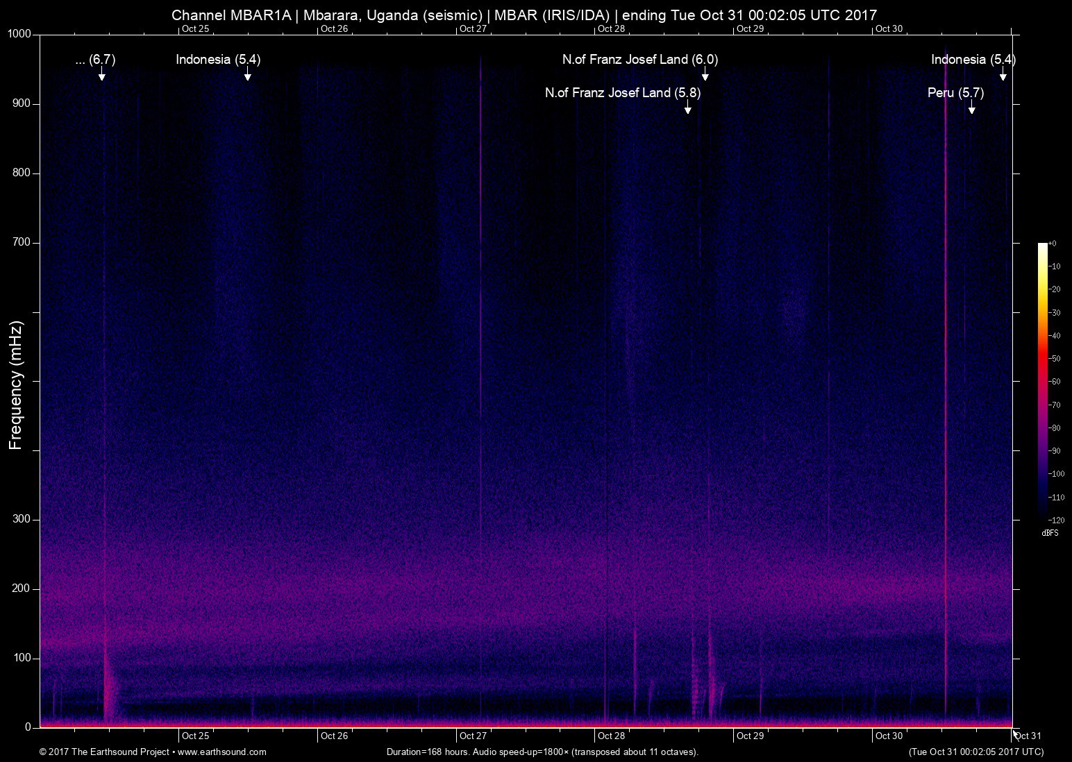
Time (UTC) Mag Lat Lon Depth Description
======================== === ====== ====== ===== ===========
Mon Oct 30 22:37:19 2017 5.4 118.95 -8.66 5 Indonesia (7km SW of Lanta Timur, Indonesia)
Mon Oct 30 17:12:06 2017 5.7 -74.69 -10.74 6 Peru (57km N of Satipo, Peru)
Sat Oct 28 19:11:01 2017 6.0 55.13 86.89 6 N.of Franz Josef Land (North of Franz Josef Land)
Sat Oct 28 16:16:06 2017 5.8 52.85 86.89 6 N.of Franz Josef Land (North of Franz Josef Land) *
Sat Oct 28 16:13:54 2017 5.8 54.50 86.89 6 N.of Franz Josef Land (North of Franz Josef Land)
Wed Oct 25 11:58:15 2017 5.4 131.08 -4.88 5 Indonesia (204km WNW of Tual, Indonesia)
Tue Oct 24 10:47:47 2017 6.7 123.04 -7.24 7 Indonesia (141km NNE of Palue, Indonesia)
Total: 7 events; 1 not plotted (*).
About this archived stream:
| Station : | MBAR (network: IRIS/IDA) at Mbarara, Uganda |
| Sensor : | Geotech KS54000 triaxial broadband borehole seismometer |
| Recorder : | Quanterra Q330 @ 100 Hz |
| Pod : | inanna@x.x.0.135 | macOS 10.12.5 | psm v. 123 |
| Speedup : | ×1,800 (transposed up about 11 octaves) |
| Loop duration (real) : | 168 hours |
| Loop duration (audio) : | 05:36 (stereo) |
| Data channels : | miniseed (II.MBAR.00.BH1 II.MBAR.00.BH2) |
| RMS : | 0.003318 |
| Spectrogram type : | raw |
| Gain correction : | 20dB |
| SoX post-processing : | highpass -2 90 highpass -2 90 compand 0.001,0.01 6:-80,-50,-40,-10,0,-3 |
| Archived on : | Tue Oct 31 00:02:05 UTC 2017 (about 9 years ago) |
| Metadata source : | auto-archived factoids |