Mbarara, Uganda (seismic) archived on October 11, 2024
Annotated events during this period:
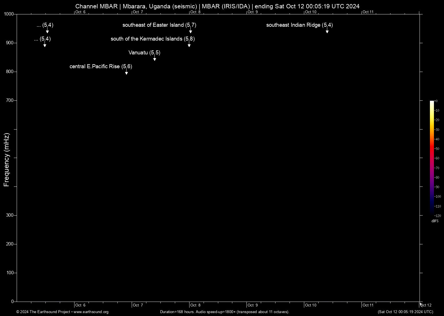
Time (UTC) Mag Lat Lon Depth Description
======================== === ====== ====== ===== ===========
Thu Oct 10 09:44:39 2024 5.4 99.96 -47.53 5 southeast Indian Ridge
Tue Oct 8 00:35:35 2024 5.7 -99.20 -36.28 6 southeast of Easter Island
Mon Oct 7 23:59:04 2024 5.8 -178.56 -33.50 6 south of the Kermadec Islands
Mon Oct 7 09:36:58 2024 5.5 169.05 -19.59 6 Vanuatu (24 km WSW of Isangel, Vanuatu)
Sun Oct 6 21:52:59 2024 5.6 -111.15 -13.58 6 central E.Pacific Rise (central East Pacific Rise)
Sat Oct 5 12:50:42 2024 5.4 -167.12 53.24 5 Alaska (81 km SSW of Unalaska, Alaska)
Sat Oct 5 11:45:30 2024 5.4 -173.45 -17.40 5 Tonga (150 km NNE of Neiafu, Tonga)
Total: 7 events.
About this archived stream:
| Station : | MBAR (network: IRIS/IDA) at Mbarara, Uganda |
| Sensor : | Geotech KS54000 triaxial broadband borehole seismometer |
| Recorder : | Quanterra Q330 @ 100 Hz |
| Pod : | ms-rhea@x.x.31.38 | macOS 12.6.4 | psm v. 176 |
| Speedup : | ×1,800 (transposed up about 11 octaves) |
| Loop duration (real) : | 168 hours |
| Loop duration (audio) : | 05:36 (stereo) |
| Data channels : | miniseed (II.MBAR.00.BH1 II.MBAR.00.BH2) |
| RMS : | 0.000001 |
| Spectrogram type : | raw |
| Gain correction : | 20dB |
| SoX post-processing : | highpass -2 90 highpass -2 90 compand 0.001,0.01 6:-80,-50,-40,-10,0,-3 |
| Archived on : | Sat Oct 12 00:05:19 UTC 2024 (about 2 years ago) |
| Metadata source : | auto-archived factoids |