Mbarara, Uganda (seismic) archived on November 21, 2024
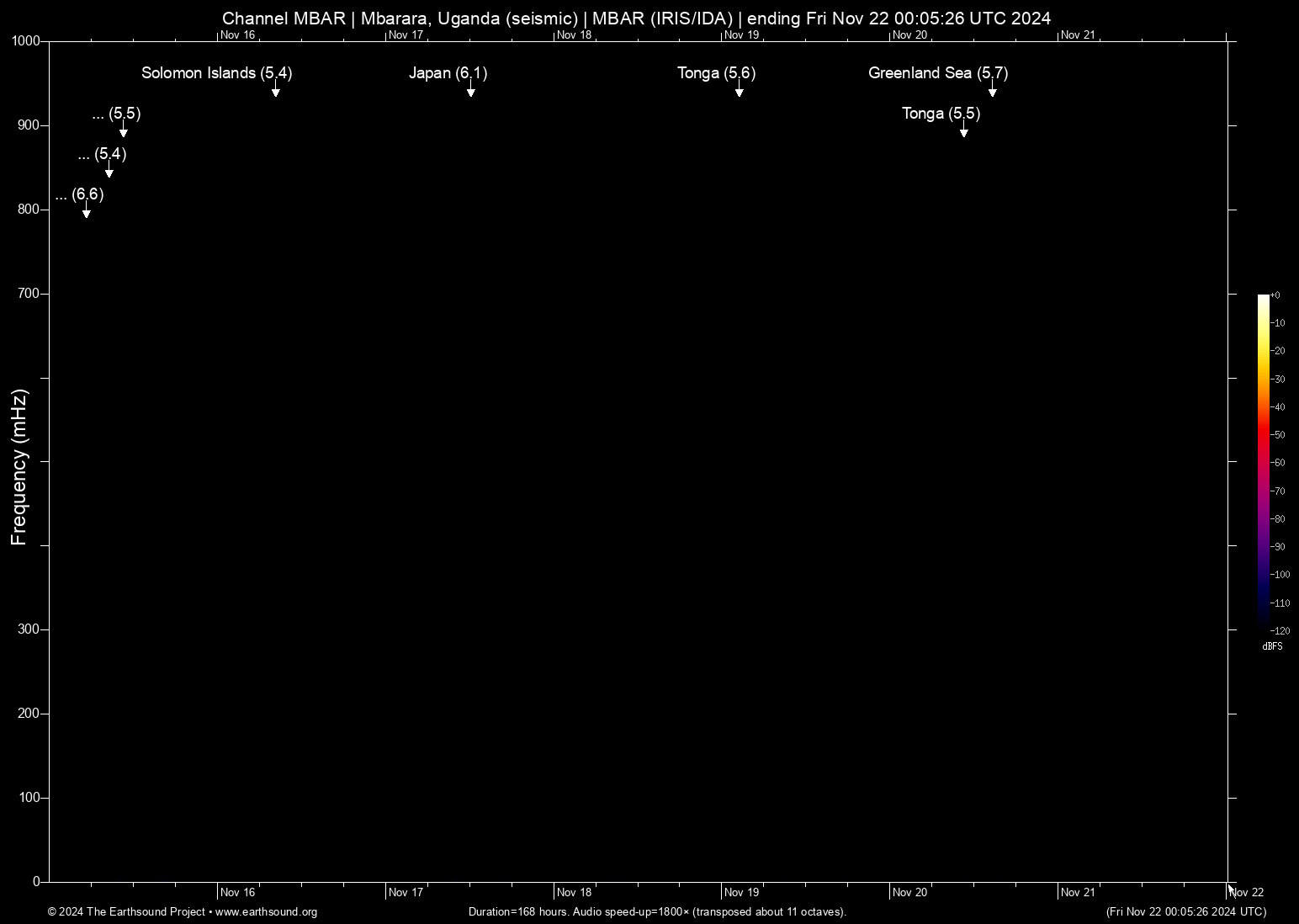
Annotated events during this period:
Time (UTC) Mag Lat Lon Depth Description
======================== === ====== ====== ===== ===========
Wed Nov 20 14:43:53 2024 5.7 1.49 79.81 6 Greenland Sea
Wed Nov 20 10:42:57 2024 5.5 -176.27 -20.73 6 Tonga (112 km WNW of Houma, Tonga)
Tue Nov 19 02:41:53 2024 5.6 -175.79 -21.12 6 Tonga (50 km W of Houma, Tonga)
Sun Nov 17 12:16:29 2024 6.1 131.40 29.05 6 Japan (155 km SSE of Koshima, Japan)
Sat Nov 16 08:22:26 2024 5.4 166.62 -12.26 5 Solomon Islands (192 km SSE of Lata, Solomon Islands)
Fri Nov 15 10:41:05 2024 5.5 153.94 -61.52 6 Balleny Islands (Balleny Islands region)
Fri Nov 15 08:41:47 2024 5.4 -172.98 -19.32 5 Tonga (129 km SE of Neiafu, Tonga)
Fri Nov 15 05:28:29 2024 6.6 153.32 -4.70 7 Papua New Guinea (123 km ESE of Kokopo, Papua New Guinea)
Total: 8 events.
About this archived stream:
| Station : | MBAR (network: IRIS/IDA) at Mbarara, Uganda |
| Sensor : | Geotech KS54000 triaxial broadband borehole seismometer |
| Recorder : | Quanterra Q330 @ 100 Hz |
| Pod : | ms-rhea@x.x.31.38 | macOS 12.6.4 | psm v. 176 |
| Speedup : | ×1,800 (transposed up about 11 octaves) |
| Loop duration (real) : | 168 hours |
| Loop duration (audio) : | 05:36 (stereo) |
| Data channels : | miniseed (II.MBAR.00.BH1 II.MBAR.00.BH2) |
| RMS : | 0.000001 |
| Spectrogram type : | raw |
| Gain correction : | 20dB |
| SoX post-processing : | highpass -2 90 highpass -2 90 compand 0.001,0.01 6:-80,-50,-40,-10,0,-3 |
| Archived on : | Fri Nov 22 00:05:26 UTC 2024 (about 2 years ago) |
| Metadata source : | auto-archived factoids |